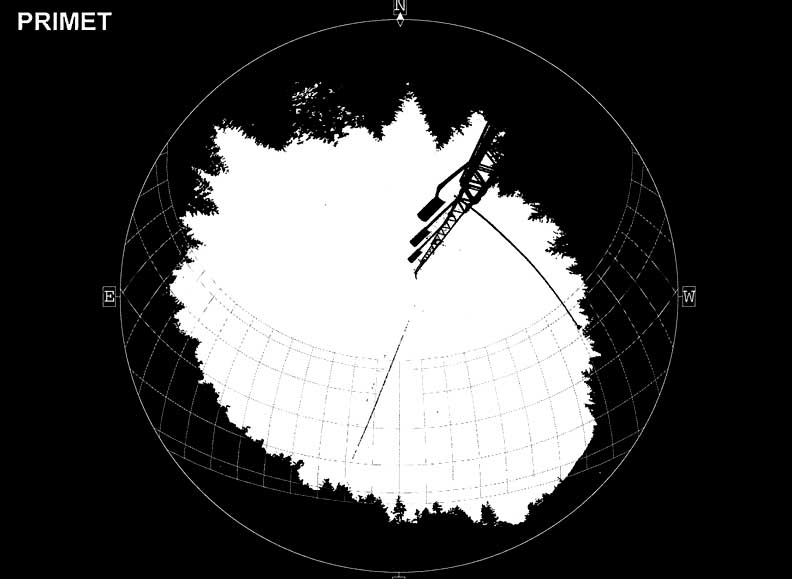
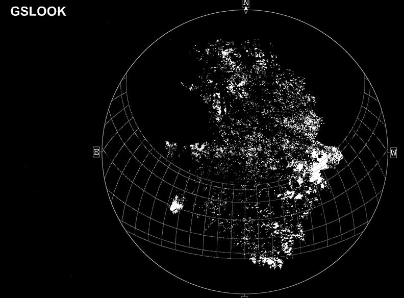
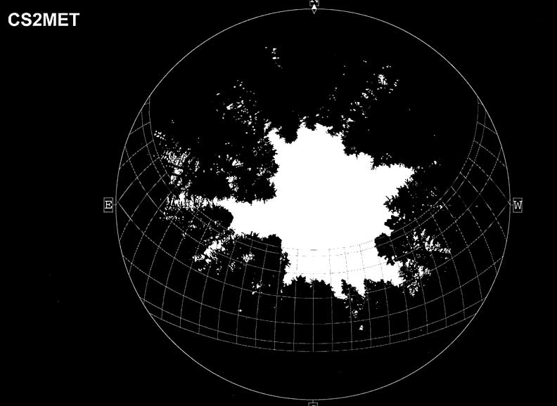
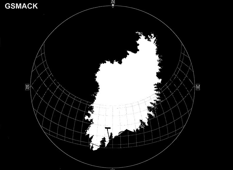
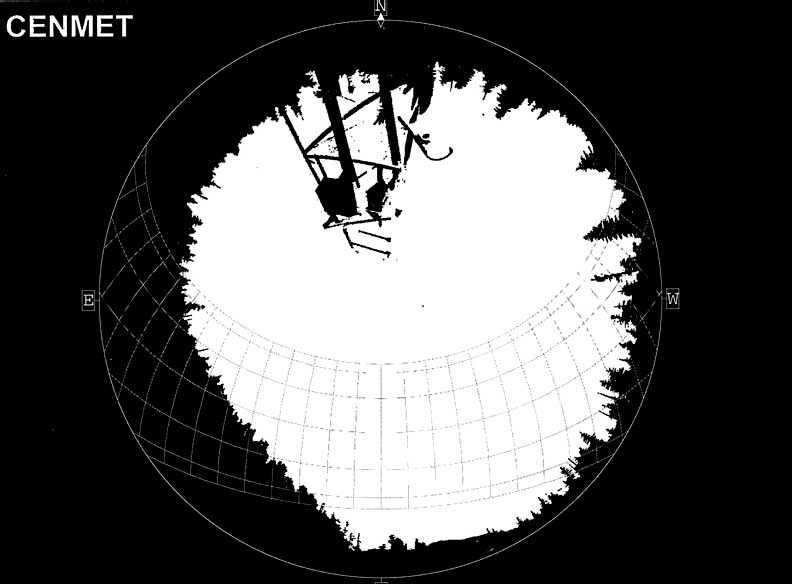
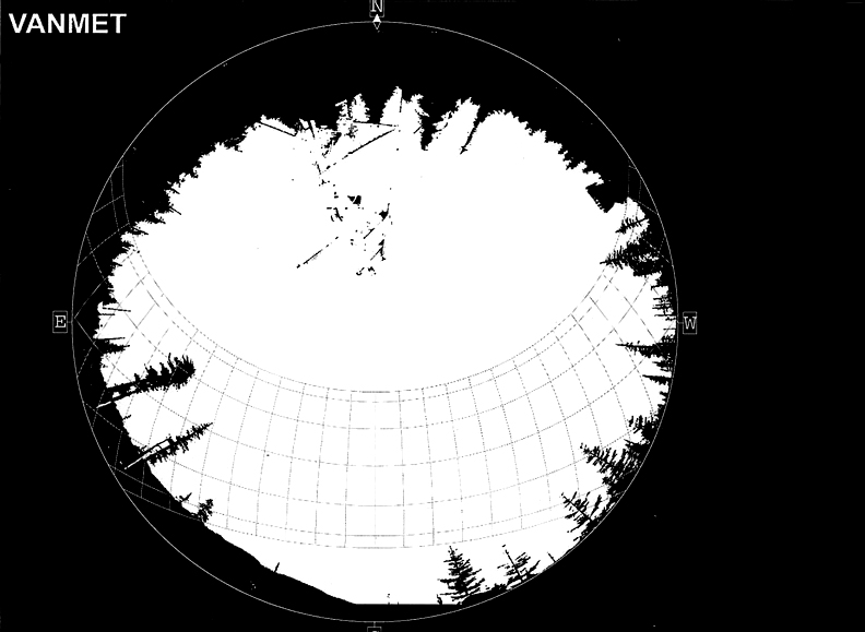
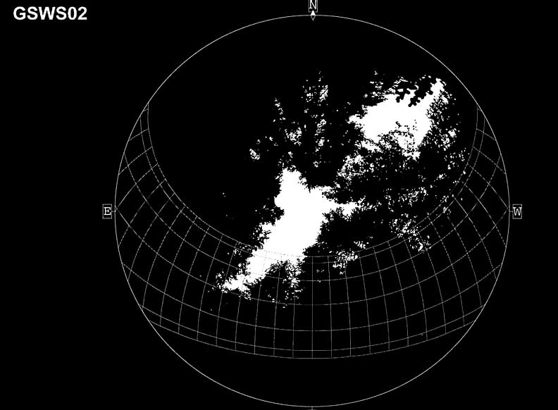
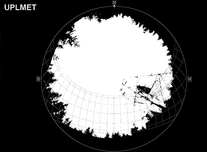
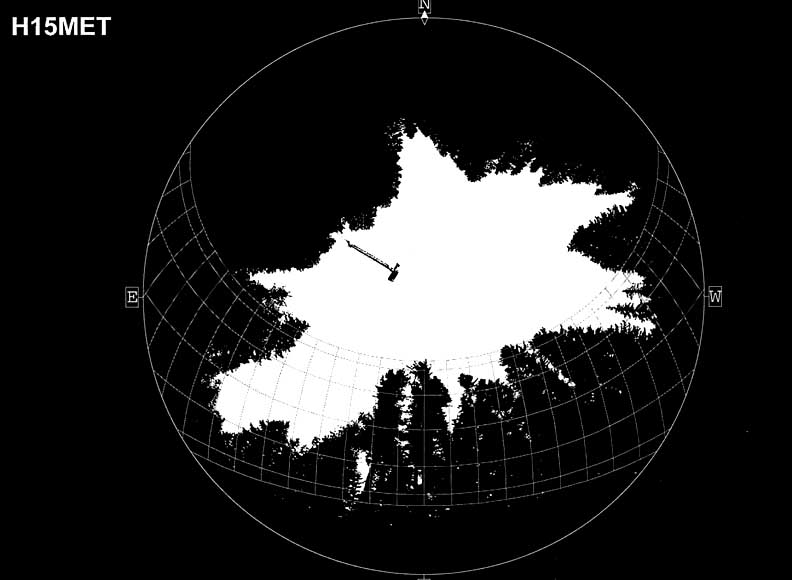
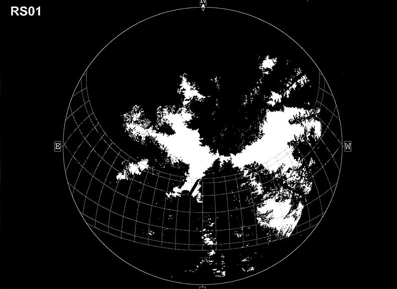
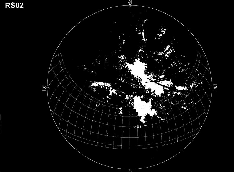
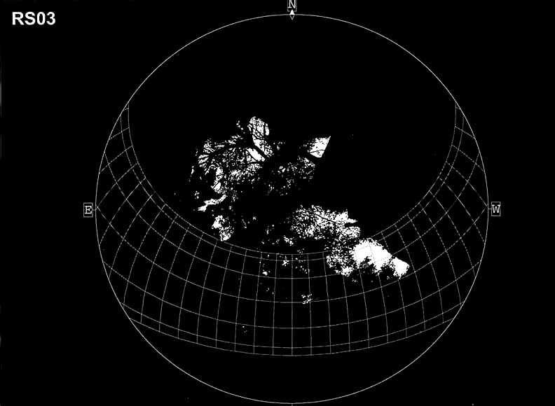
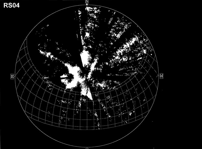
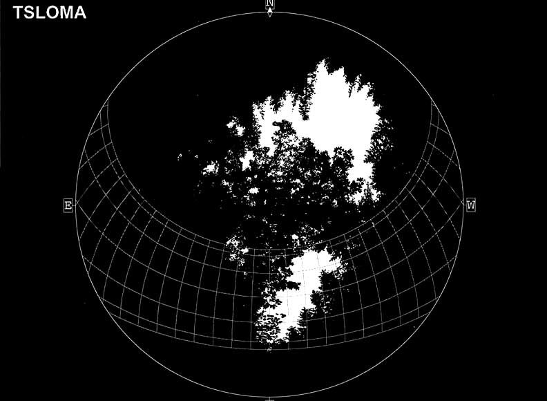
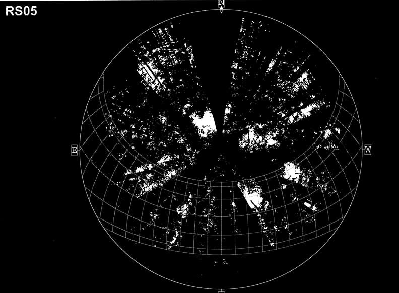
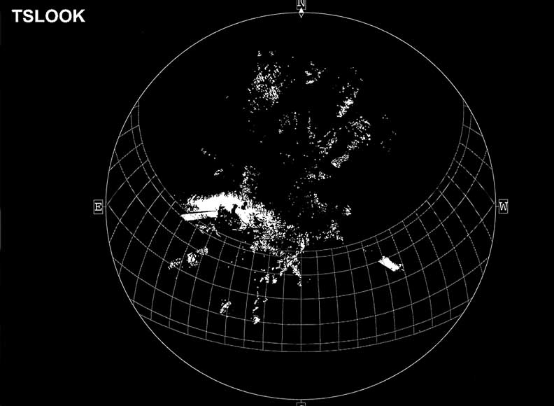
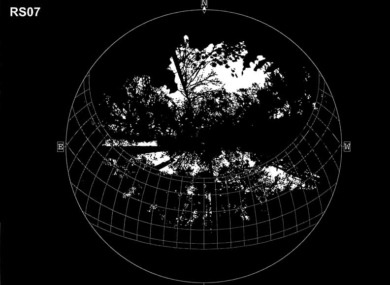
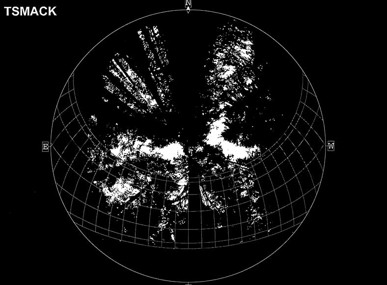
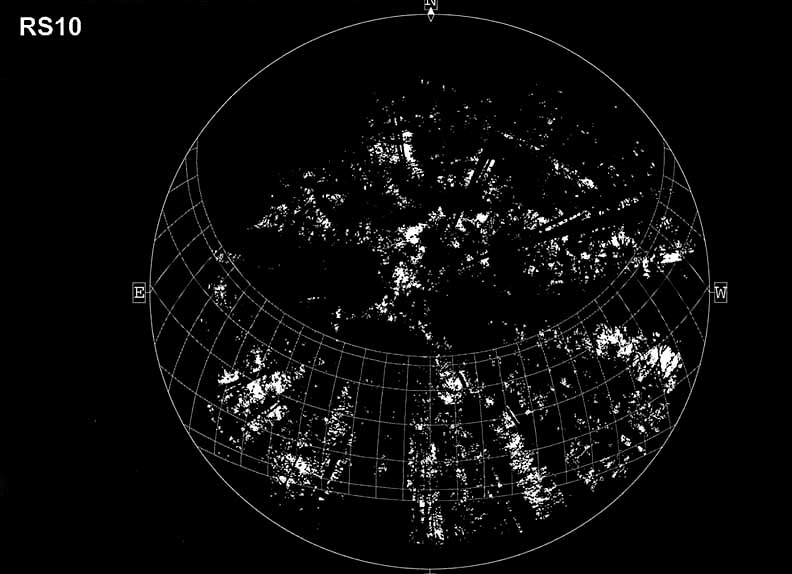
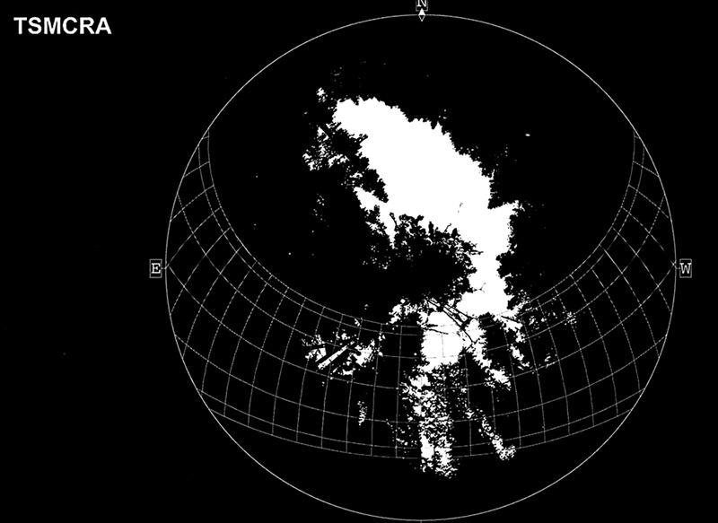
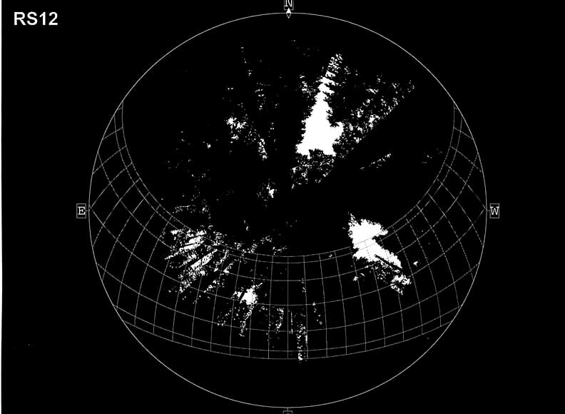
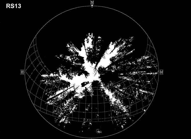
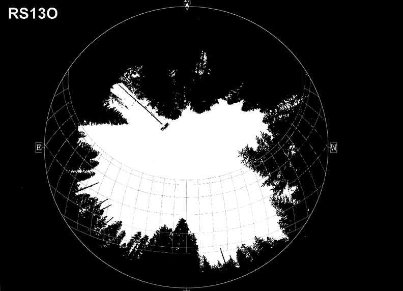
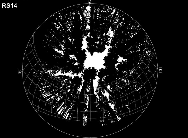
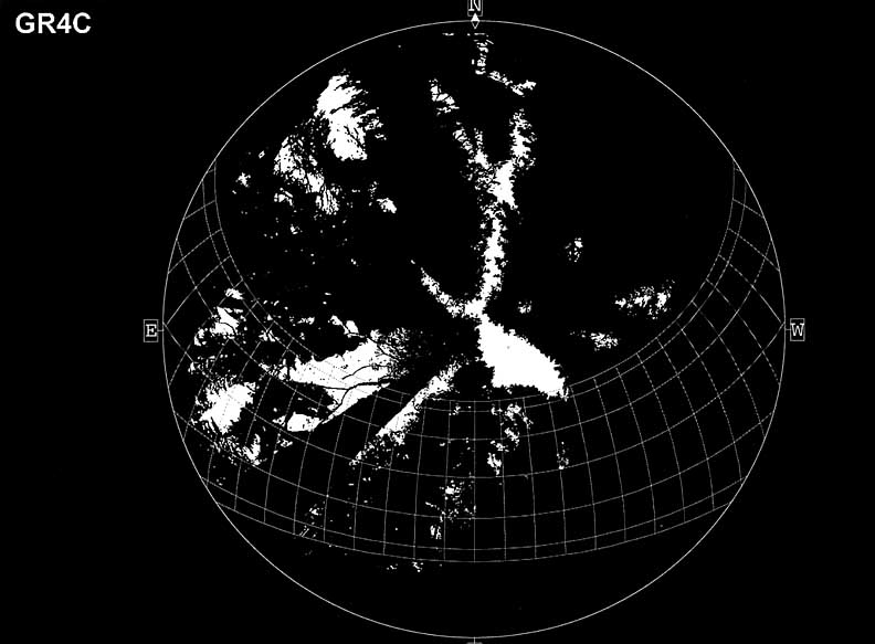
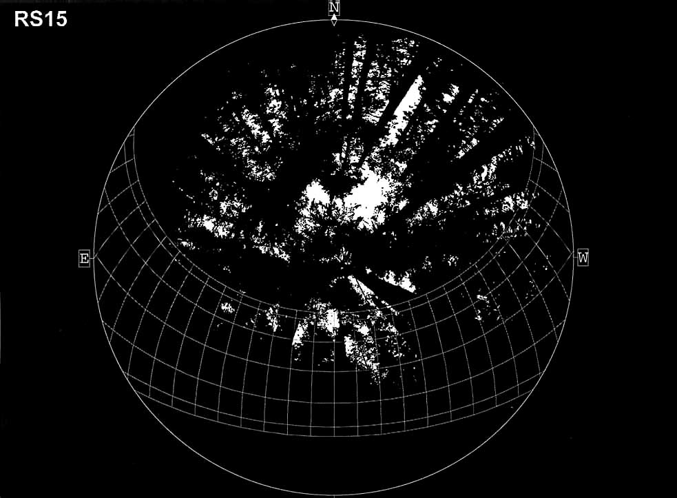
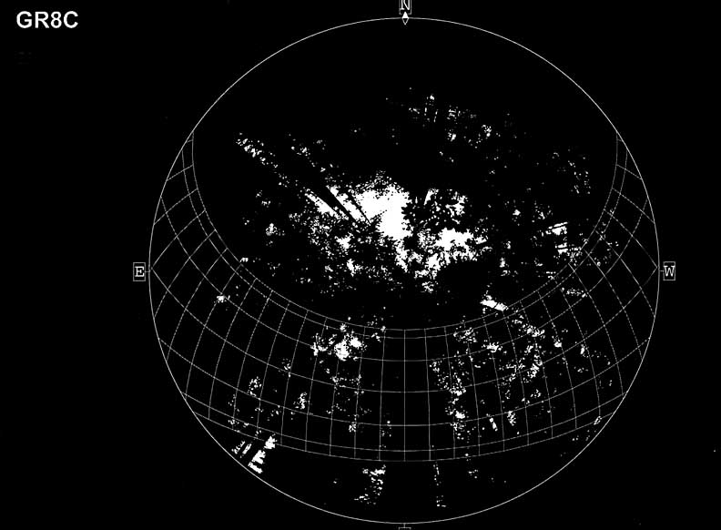
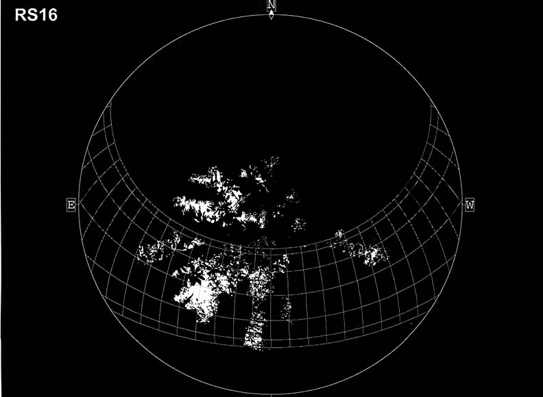
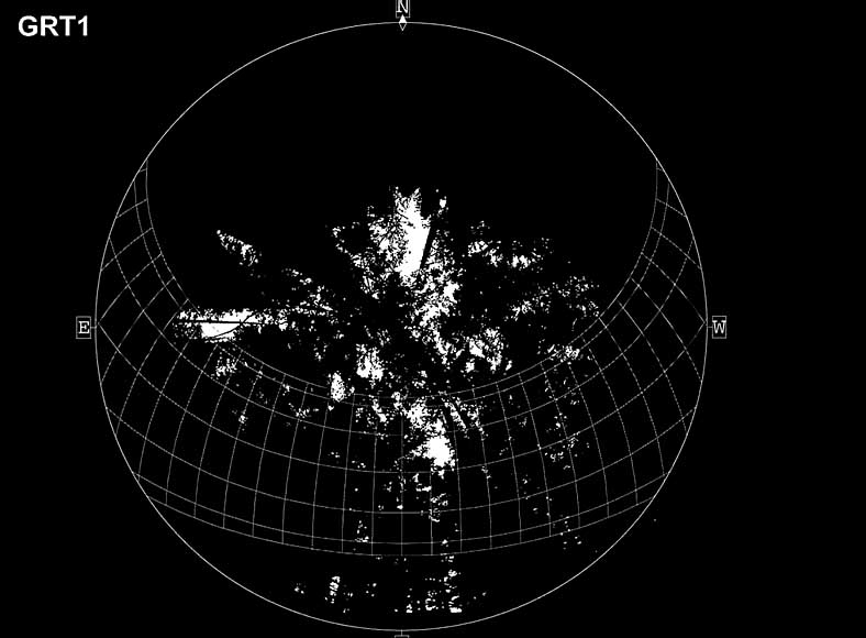
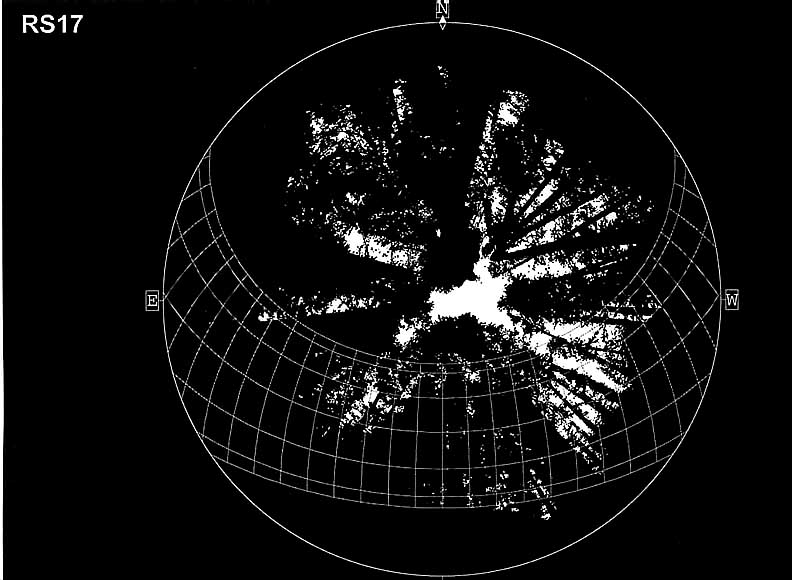
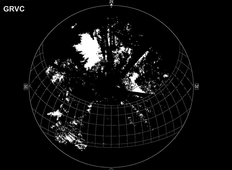
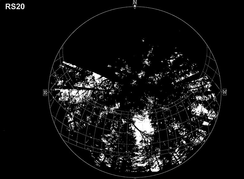
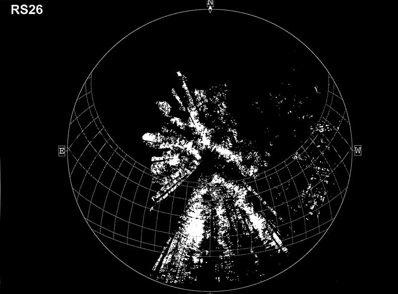
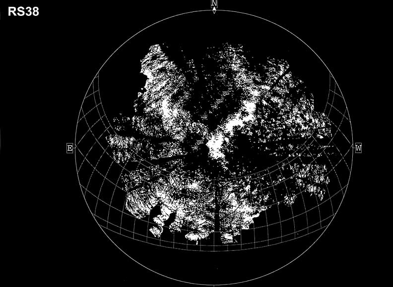
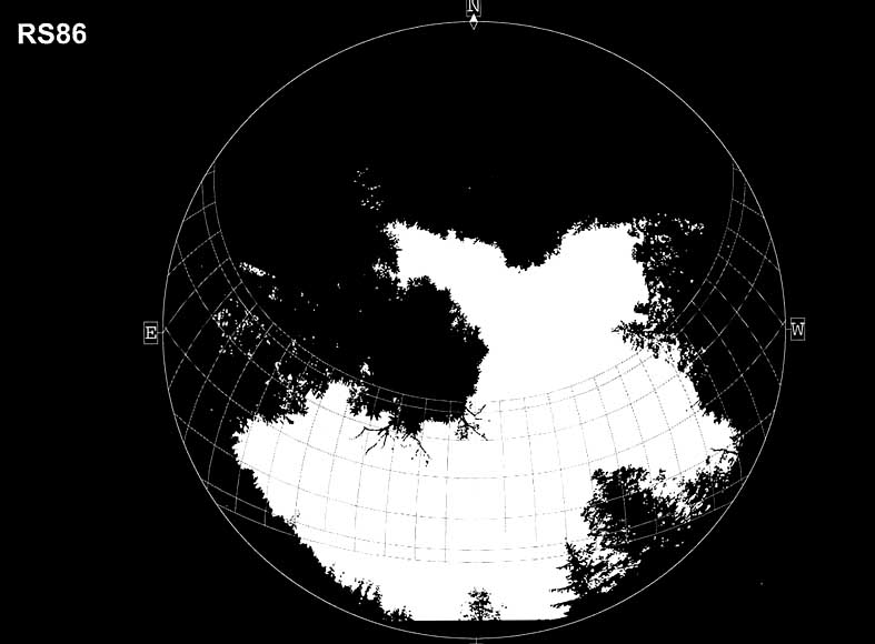
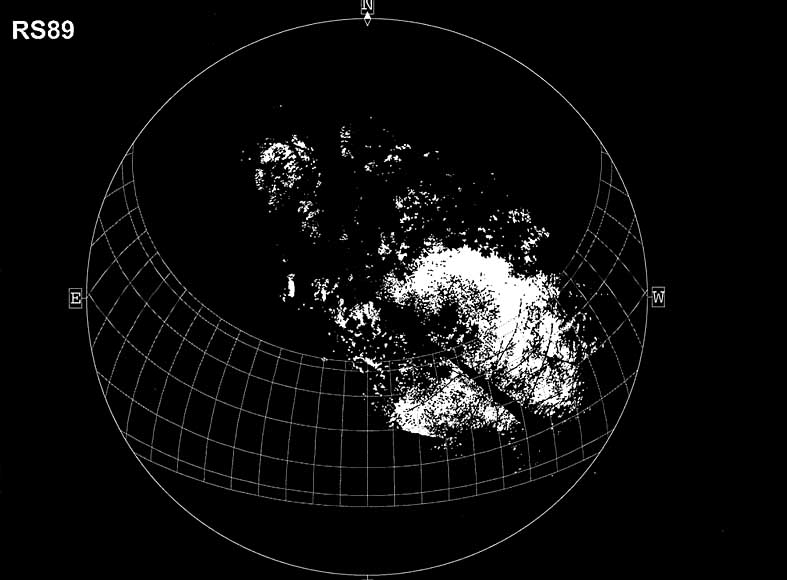
Fisheye Photographs of HJ
Andrews Climate Stations
Click on the following to view
fisheye images taken at each climate station used in the study. These are the processed images used for
analysis, complete with suntracks for every other month throughout the year and
cardinal directions labelled. HemiView
software was used to analyze these images to determine the amount of solar
radiation blocked by canopy cover. Each
photograph was taken such that the top of the image is pointing due north
(magnetic declination taken into consideration). Attempts were made to minimize glare effects of direct sun by
taking pictures early in the morning and late in the afternoon, or under
overcast skies.
All photographs were taken during
August 2001. Images for sites no longer
operational were taken from locations based on a ‘best guess’.
MET SITES GAGING
STATIONS
REFERENCE STANDS GSWS08
RS02 THERMOGRAPH SITES
RS13 GRIFF SITES